NYC Flood Map: How to Check Your Address for Stormwater and Coastal Flood Risk
To check your address on an NYC flood map, look at two maps, not one. The city's Stormwater Flood Maps model where heavy rain is expected to pond on the streets, including a 2050 scenario. FEMA's flood maps show coastal flood zones from storm surge, and FloodHelpNY lets you search them by address. Ida is the reason to check both: only 6.9% of the buildings it damaged in New York City were in the 100-year floodplain.
GlobePro Restoration is a 24/7 restoration company based in Brooklyn. If the map turns out to be right about your block, call (929) 969-2534.
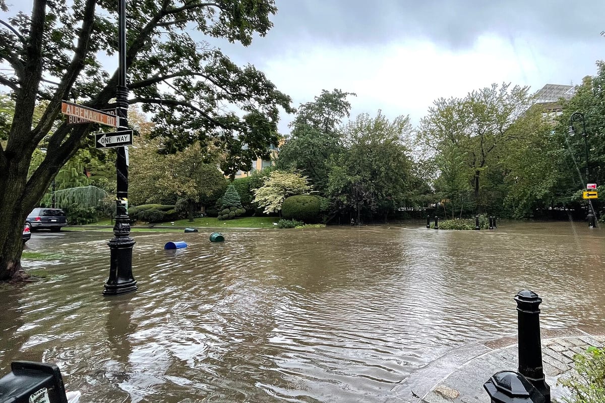
Albemarle Road, Flatbush, during the Sept. 29, 2023 flash flood. Photo: Wil540 art, CC BY-SA 4.0, via Wikimedia Commons.

Two kinds of flooding, two kinds of NYC flood map
The city's 2021 Stormwater Resiliency Plan sets the two side by side. Rain-driven flooding often comes with little warning, most of the ponding lasts seconds to a few minutes, and it hits scattered spots wherever the heaviest rain falls. Coastal flooding follows the tides, so forecasts can give some warning; tide-driven surge can last 20 minutes to an hour and covers long stretches of shoreline. When heavy rain, a coastal storm and the tide line up, the plan says additional flooding can occur.
Each map covers one of those. The city's stormwater map viewer says plainly that it shows flooding from rain only and does not represent risk from coastal flooding or storm surge. FEMA's maps cover the coastal side, and they are the ones flood insurance is built around.
How to check your address on the NYC Stormwater Flood Map
1. Go to nyc.gov/stormwater-map, which opens the city's map page, and open the map viewer from there. 2. Read the notice that pops up and close it. 3. Pick a scenario from the buttons along the bottom. 4. Use the map's search tool to find your address, then zoom in to your block. 5. Read the colors against the legend.
The legend has two flood depths. "Nuisance flooding" is at least 4 inches but less than a foot deep. "Deep and contiguous flooding" is a foot or more. Gray marks areas the analysis didn't cover, and wetlands and open water are shown separately.
The four scenarios in the current data, updated October 17, 2024, are:
- Limited flood: 1.77 inches of rain an hour, at today's sea level.
- Moderate flood: 2.13 inches an hour, at today's sea level.
- Moderate flood with 2050 sea level rise: the same 2.13 inches an hour, with the higher seas projected for 2050.
- Extreme flood with 2080 sea level rise: 3.66 inches an hour, with 2080 sea levels.
For scale: city sewers typically have capacity for about 1.75 inches of rain an hour, according to the Ida recovery plan, and DEP expects a storm that intense roughly once every five years. During Ida, the National Weather Service recorded 3.15 inches in Central Park in a single hour, between 8:51 and 9:51 p.m.
Reading the 2050 NYC flood map scenario
The 2050 map uses the same rainfall as the moderate map at today's sea level. The difference is the higher sea level. The Stormwater Resiliency Plan explains that adding sea level rise shows areas that temporarily can't drain because high water is blocking storm drains and outfalls. Compare the two moderate maps for your block: if the 2050 shading is wider, blocked drainage at high tide is the likely reason.
What the stormwater map can't tell you
The viewer's notice lists its own limits:
- It shows areas of potential flooding of at least a quarter of a contiguous acre with water 4 inches deep or more, so a small low spot on your lot may not appear.
- It does not give the exact depth of flooding at any location.
- It doesn't account for private drainage, clogged or obstructed drains, or new construction.
- It is not for floodplain determination.
The city's map page adds that the scenarios assume rain falls evenly across the city, that drains work as designed (catch basins not matted over with leaves), and that large properties such as airports drain on their own. They also leave out coastal protection projects still being designed or built.
The biggest gap for a homeowner is the basement. The viewer says the maps show the relative risk of flooding in public areas from rain runoff; they say nothing about sewer water coming up through a basement floor drain. By DEP's count, a storm of 1.75 inches an hour puts about 74,000 properties at risk of sewer backups, so an unshaded block doesn't mean a dry basement. Our guide to backwater valves in NYC covers that risk.
How to check your coastal flood zone
The city's flood map site lists two ways to find your FEMA flood zone: FEMA's Region II coastal map site, and FloodHelpNY, run by the Center for NYC Neighborhoods. FloodHelpNY's address search shows your flood risk and an estimated flood insurance rate. You can also view the maps in person at your borough's Department of Buildings office.
The zone to look for is the high-risk area, which FEMA calls the Special Flood Hazard Area, also known as the 100-year floodplain. The city's flood map site explains that it has a 1% chance of flooding in any given year, which works out to a 26% chance over a 30-year mortgage.
The maps themselves are in flux. FEMA released preliminary flood maps for the city in January 2015; the city appealed that June, and in October 2016 FEMA agreed to revise them, with new maps expected "in the coming years," according to the city. In the meantime, the city's building code requires new and substantially improved buildings to use the 2015 preliminary maps. Ask your insurer or agent which map they are rating your home on.
What Ida showed about flood zones
The city's Ida recovery plan is the best argument for checking the stormwater map even if you're nowhere near the water. About 33,500 buildings were damaged, 3.3% of all buildings in the city. Only 6.9% of them were in the 100-year floodplain and 13.7% in the 500-year floodplain. Small homes took the worst of it: one- and two-family houses make up 52% of the city's building stock and 75% of what Ida damaged, mostly in basements and ground floors.
The water found two ways in: through doors and windows, and up out of the sewers through plumbing fixtures. Most of that damage happened outside the 100-year floodplain that FEMA's maps are built around.
Your block is shaded. Now what?
DEP's Rainfall Ready guidance for one- to four-family homes:
- Before heavy rain, clear debris from the curb line and the tops of catch basins so water can drain.
- Raise what's stored in the basement off the floor, and set up sandbags or deployable barriers when an intense storm is coming.
- Keep food, water, medicine and batteries for 24 hours so you can stay in during the worst of it.
- Sign up for Notify NYC, the city's official emergency alerts.
- Get flood insurance, and check whether your policy covers flood damage or sewer backups. DEP says most standard policies don't.
New York's Department of Financial Services adds that flood damage is covered by its own National Flood Insurance Program policy, which usually has a 30-day waiting period, so it has to be in place well before the storm. If someone in your building lives below grade, read our guide to basement flooding cleanup in Queens, which covers basement safety and Ida's lessons.
If the water gets in anyway
GlobePro Restoration finds every place the water got in and dries out all the affected areas. Once everything is dry, the repairs begin. We work with your insurance company to make the process as smooth as possible. For 24/7 water damage restoration anywhere in New York City, call (929) 969-2534.
Frequently asked questions
How do I find out if my NYC address is in a flood zone?
Search your address on FloodHelpNY for your FEMA coastal flood zone, and on the city's Stormwater Flood Map at nyc.gov/stormwater-map for rain-driven flooding. You need both, because each covers a different kind of flood.
What do the colors on the NYC stormwater flood map mean?
The lighter category, "nuisance flooding," is 4 inches to under a foot of water. "Deep and contiguous flooding" is a foot or more. Gray areas were not included in the analysis.
Is there an NYC flood map for 2050?
Yes. One of the four stormwater scenarios is a moderate storm of 2.13 inches an hour with the sea level rise projected for 2050. Another is an extreme 3.66-inch-an-hour storm with 2080 sea levels.
If my address isn't in a flood zone, do I need flood insurance?
That's your call, but consider the numbers: Ida damaged about 33,500 buildings and only 6.9% of them sat in the 100-year floodplain, and standard homeowners and renters policies leave out flood damage, per DFS. DEP's Rainfall Ready guidance tells renters and owners of one- to four-family homes in at-risk locations to get flood insurance.
Water in your home now?
Call GlobePro Restoration at (929) 969-2534, 24 hours a day, 7 days a week, or send a request. We serve New York City and the surrounding areas.
More from the blog
- Mold Testing vs. Remediation on Long Island: Why NY Wants Two Firms
- Smoke Damage Insurance Claim in New York: What to Document Before Cleanup
- What Is Water Damage Restoration? Mitigation, Drying and Repairs Explained
- Smoke Damage Cleanup in an NYC Apartment After a Neighbor's Fire
- Does Homeowners Insurance Cover Sewer Backup in New York?